UPSC CSE Prelims 1997
The following map shows four of the sixteen Mahajanapadas that existed in ancient India:
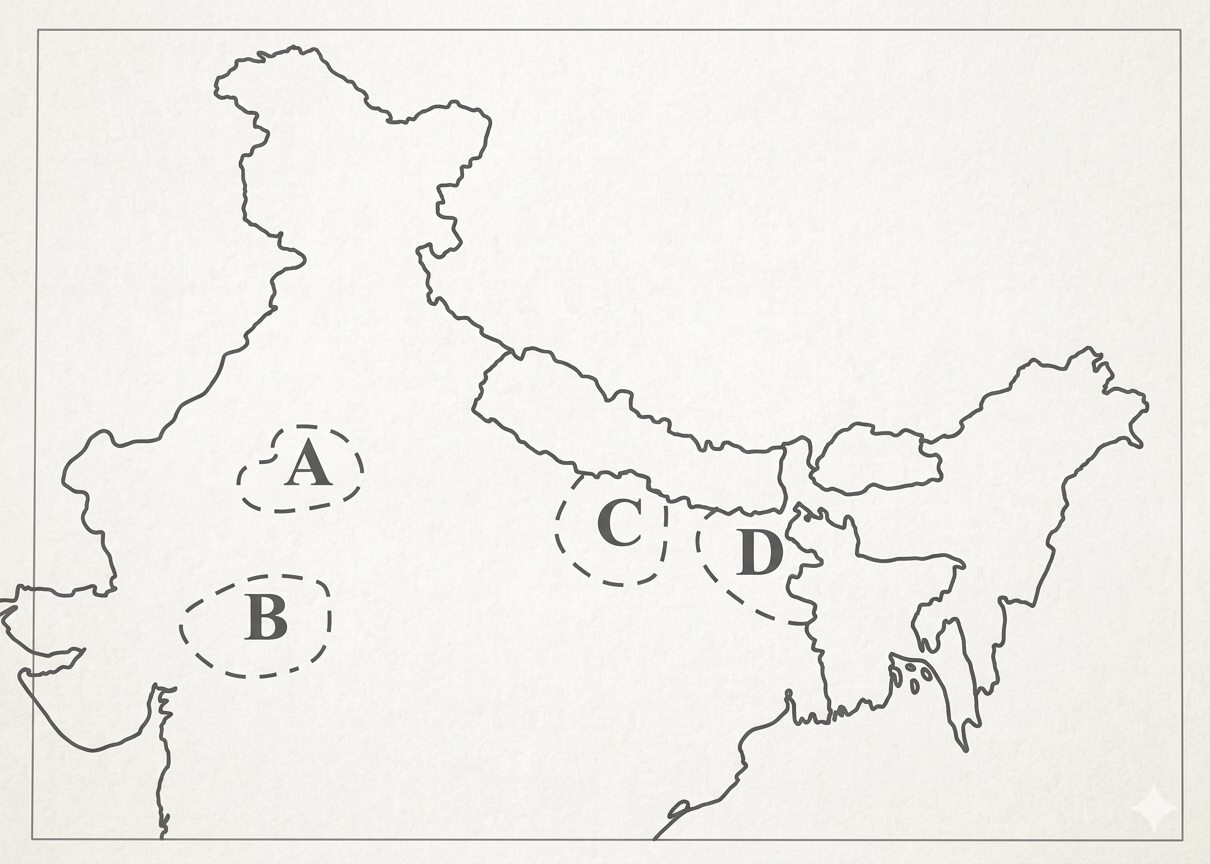
The places marked 1, 2, 3 and 4 respectively are:
EXPLANATION
Correct Option
Location 1 represents Matsya, a Mahajanapada situated in the region of present-day Jaipur, Alwar, and Bharatpur in Rajasthan. Its capital was Viratnagar.
Location 2 represents Avanti, located in the Malwa region of central India, corresponding to modern Ujjain and surrounding areas in Madhya Pradesh. Its capital was Ujjain.
Location 3 represents Vatsa, centered around the confluence of the Ganga and Yamuna rivers, near modern Prayagraj (Allahabad) in Uttar Pradesh. Its capital was Kaushambi.
Location 4 represents Anga, situated in eastern Bihar, encompassing the modern districts of Bhagalpur and Munger. Its capital was Champa.
Incorrect Options
Option A is incorrect. While Matsya and Anga are correctly identified for locations 1 and 4, location 2 is Avanti, not Cedi. Cedi was located in the Bundelkhand region. Similarly, location 3 is Vatsa, not Kosala. Kosala was situated in the Awadh region of Uttar Pradesh.
Option B is incorrect. Location 1 is Matsya, not Surasena. Surasena was centered around Mathura. Location 4 is Anga, not Magadha. Magadha was located in southern Bihar, with its capital at Rajagriha and later Pataliputra.
Option D is incorrect. None of the Mahajanapadas listed in this option (Surasena, Cedi, Kosala, Magadha) correctly correspond to the marked locations 1, 2, 3, and 4 respectively on the map.